Thursday 30 April 2015

So where have we been since Berrima. UPDATED

Yvonne commented to tell me that that the Dog on the Tucker Box is not at Gunnedah but is on the road to Gundagai, which is absolutely correct.  What was I thinking.......anyway, have updated this post.  Thanks Yvonne for taking the time to point that out to me, much appreciated.

                                                       ðŸ”¹ 🔹 🔹 🔹 🔹 🔹 🔹 🔹 🔹


I can't believe that the last time I updated my travel blog, it was to write about Berrima which was in February and it is now nearly May and we are crossing to Tasmania on Monday night, 27th April 2015.

Originally we were booked to go to Tassie at the end of March but when we tried to make caravan park bookings we found out that everything was pretty much booked out because of school holidays, Easter and the V8 Super Cars.  One person told us that there are free camps (which we know) but our chances of getting in any of them was less than zero.  So, not being in any rush, we delayed the trip by a month.

So where have we been since Berrima.

We have stayed at Gundagai, Rutherglen, Beechworth, Seymour, Melbourne, Rosedale, Moe, Franklin River Reserve (Toora), Leongatha, and Phillip Island and back to Melbourne.

Along the way we have visited Corowa, Bright, Milawa, Warragul, Morwell, Traralgon, Walhalla, Yarram, Toora, Foster, Wilsons Promontory, Korumburra, Inverloch and Wonthaggi (twice).

You can see that we have been to a number of places in the past two months.  It seems a lot when it is written down, it but it has been a lazy trip around the country side.  All the places we have been to with the exception of Corowa (just didn't like the place) were great and we would certainly go back one day.

We absolutely loved our bush camps at Rosedale and the Franklin River where we stayed twice although we were naughty and stayed much longer that then the 48 hours allowed the second time we were there.  If fact, we became “known”!  When Nick and John went into Foster, a shop person said “Oh, you are the people in the two caravans at Franklin who have been there for a while”.  They then proceeded to say that the council didn't like all the fires that were being lit on the grass there.  And there were a lot of burned patches of grass because people just don't care and make fires anywhere without any thought of the damage they are causing.  Over Easter the place was packed and it seems that people were staying there for a couple of weeks or more but tended to stay on the lower side next to the river which is not visible from the road.  We on the other hand stayed up the top near the road because we would get more solar power there…. if the sun came out that is.

Anyway,  John was able to tell them that we used an existing fireplace, and that he had gathered stones to surround it to make it safe and that when we left, we would remove the stones, the ash and put soil and mulch there in the hopes that the grass would grow after some rain.  Mind you, it was a bit wet and John and Nick had to pull the local council worker out when his ride-on mower got bogged.   He got bogged twice but another council worker came along and got him out the first time.

Our fire at Franklin River Reserve, Toora, Victoria
Back to Melbourne.  We met up with our good friends and travel buddies, Deb and John, in Melbourne in the first week of March when they picked up their brand new van and we have been traveling with them ever since and they are coming to Tassie with us...yay.

The next few posts will run through where we have been but Nick and I did Gundagai down to Melbourne without Deb and John.  So, starting with Gundagai, home of the “Dog on the Tuckerbox”.  No photo for you though.   The historical monument is only 8 km out of town but as we were on an overnight stop, we didn't want to unhitch and go there.   A Tuckerbox is Australian slang for a lunchbox.  The “Dog on the Tuckerbox” was made as a tribute to pioneers and the statue was inspired by a bullock drover’s poem, Bullocky Bill, which celebrates the life of a drover’s dog that guarded a man's tuckerbox.  The statue was unveiled by the then Prime Minister of Australia, Joseph Lyons, on 28 November 1932.

Gundagai is a lovely typical country town with nice friendly people, old houses and buildings, some well kept, some not so.  It is a bit hilly but there was a lovely walking/cycle track covered by huge trees which also had a playground.  As usual, we went for a walk around which is the best way to see a place.  We passed some friendly locals who had met at a coffee shop and I would have liked to have joined them but Nick had left his wallet behind so …no …..coffee.

Along the walk before a bridge crossing the Murrumbidgee River is a marker showing the high flood marks.  You can see it here in the photo with the bridge and the river behind it. The highest was 41ft 4 inches  (just over 12 metres) on 3 July 1853.  Standing there it is hard to comprehend that much water.  More recently, on 3 March 2012, the flood level was 35 ft 9 inches (just under 11 metres).

Flood Marker -  Murrumbidgee River - Gundagai
The caravan park was quite unusual too as it had rows of undercover parking, each with its own ensuite which you didn't have to pay for and use if you didn't want to.  There were some grass sites too.  Parking undercover meant we didn't have to put the awning out and we had a nice concrete area to sit in with our 5 o’clock drinkies.

Undercover 5 o'clock Drinkies....,
Had dinner at the local club.  Club was OK but the Chinese meal was the worst I have ever had.  Has put me off having Chinese for a while.

Next stop ….the Victorian High country.

Wednesday 8 April 2015

Berrima (23/02/15 - 24/02/15)


Our sole purpose for going to Berrima was to visit my old friends John & Lorna who I have not seen since we left Sydney for Cairns in 1987, although Lorna recounts that they came to visit Nick and I when we lived in the Blue Mountains, (1995 - 2001) an event that I am unable to recall.  But, that is not surprising as my Mother always said that I had a terrible memory.   So, Lorna must be correct.

The first night there were two other caravans, and they both left  he following day, which was just as well because it was rainy and overcast as we were not getting any solar power we had to run the generator to top up the batteries.

Berrima Reserve is a lovely little spot in the historic town of Berrima in the Southern Highlands of New South Wales, on the old highway between Sydney and Canberra.

Our camp site at Berrima Reserve
View of the bush from our site
Crimson Rosella, one of many that were flying around
There are a number of historic buildings in the town and the village as a whole is listed on the Register of the National Estate. Notable buildings include the Holy Trinity Anglican Church built in 1849, the St Francis Xavier Catholic Church built 1849-51, the courthouse built between 1833 and   1838, the gaol built from 1835 by convict labour and opened in 1839 and The Surveyor General Inn which was built in 1834 has been continuously licensed since 1839. The notion that it is the earliest hotel in the area is supported by its continual license and being in the original building.


Holy Trinity Anglican Church
The Courthouse 
The Berrima Goal 
Beautiful Rose garden at the Goal... full of yellow roses
Outside of the Surveyor General Inn
Around the 1840’s, you would have found 14 hotels in or near Berrima but the population decreased when the construction of the railway bypassed the town and no new houses were built for a hundred years.

The Berrima Village Trust was established in 1963 to preserve historic buildings.

Although we had visited Berrima many times over the years, we were not aware that it was actually the site of a German Internment Camp and gained an insight into that period of time by going on the river walk which started at our campsite.

March 1915 saw the first group of 89 internees arrive Berrima on foot.  The goal was cleaned up and made secure for their internment. By 1918 the goal was overcrowded with nearly 300 internees.  They were locked up overnight and after morning roll call they were free to roam within a two mile radius  of the goal, returning for roll call at 5pm.  Some came with their own household goods and furniture and they had money to buy bread, meat and provisions from the local store.

Most of the Germans could speak enough English to communicate well with the locals.   It is reported that they were “polite and well behaved”.  By all accounts, they were also an industrious lot and they created gardens, built a bridge and a flotilla of canoes on the Wingecarribee River. People from other areas came to sightsee, to see the “Huns”, to swim and have picnics by the river. It was the Berrima’s first tourism industry.

Berrima River showing some of the structures the German Internees built along the banks
However, some people only came to cause trouble and pick fights and so the internees were allowed to erect a high barbed wire fence enclosing 17.5 acres of the left bank of the river for their own use which became known as “The Compound”.  The right bank was free for all to use.

The internees built Villa’s and Huts which, in time, extended far beyond “The Compound” along the banks of the river.  Apart from the many buildings there was a small school room, a bakehouse that served pastries and coffee, an open air amphitheatre on a bend in the river and of course, a still.


The camp canteen was managed by the internees as a commercial operation and the profits funded the purchase of German delicacies from Sydney, vegetable seeds, the renting of grounds to grow crops, buying instruments for the camp orchestra and purchasing materials to make Christmas presents for the children of the camp.  Funds were also used to employ internees who received no wages from their companies.

Education classes were established which included theatre, music, carpentry, joinery, shorthand, photography, drawing & painting, navigation and marine skills and wireless courses.  They even installed a generator long before the village had power.

School Photo, three of the four girls that were taught there.
The walk along the Wingecarribee River gives a fascinating insight into that time period.  The walk through the bush on the banks of the river has numerous sign posts with information and photos of the buildings that used to be there.  

One of the sign posts along the walk.
The Germans at the Berrima Internment Camp were certainly hardworking and made the best of the situation that that they found themselves in.  When the guns were silenced in November 1918,  they thought they would be leaving within weeks.  However, it was 10 months before the Germany formally signed the Peace Treaty in June 1919.  It was this waiting period that caused the internees much grief, creating depressing amongst all.

However, on 12 August 1919, the internees assembled to leave Berrima for Sydney via Moss Vale where they boarded a train.  Many locals had mixed feelings about the internees departure as the German internees had brought an alternative culture and much prosperity to the village of Berrima.

Tuesday 7 April 2015

Sydney (02/02/15 - 22/02/15)

We had such a lovely social time in Sydney catching up with family and friends, the time just flew by. Met a new member of the family, Albert, along with his parents Sarah & Kim.  Caught up with Troy & Suzie and their beautiful daughter, Makayla, along with Suzie's lovely parents, Carmen and Ray.    Also Greg & Eileen as well as some family members we have not seen for a long time, Sue & Kevin and Pam & Phil.   Had a long lunch with a girlfriend, Christine, who we have not seen for over 20 years.   Met up with our lovely friends of many, many years, Liz & Bruce, Heather and Bruce & June.  Missed out on catching up with Bob & Janine, but they have a lot of their plate just now...hope they enjoyed their weekend away.  Apart from going for Yum Cha with Liz & Bruce, we had  a sleepover at their place.  What a night that was, drinking, eating, playing old maid, did I say drinking....and of course laughing.  We were in no fit state to drive to Cronulla for breakfast the following day...need I say more.......

We stayed at Lane Cove National Park in Sydney where we have stayed on a number of occasions now.   It is a great spot, close to the city and walking distance to a railway station.  There are also a number of shopping centres close by.  I am not going to say much about Sydney itself..... would rather talk about Lane Cove.
Our site amongst the gum trees
Lane Cove National Park (372 hectare / 920 acre) is a beautiful pocket of bushland located about 3km from Chatswood and 11km from the city of Sydney. The park consists of land near the banks of the Lane Cove River which flows into Sydney Harbour and extends to the outskirts of the suburbs of Pennant Hills and Wahroonga. It is surrounded on all sides by developed suburban areas which makes it a great day area for locals where one can fish (in some areas), picnic, ride bikes and  or bush walk.

Governor Phillip was the first European to lead an expedition into the Lane Cove River Valley not long after the arrival of the First Fleet in January 1788.  The Lane Cover River was further explored by Lieutenant Ralph Clark, along with three convicts.  They rowed some 10 kms up the river and recorded that they saw Aboriginal people.

Around 1814, William Henry began farming on land north of Blue Gum Creek, adjoining the Lane Cove River, near the present Fullers Bridge.  He lived at his farm “Millwood” from 1814 to 1850 and that is what is now known as the Fuller picnic area.  Governor Bligh had promised William Henry 1000 acres in the area but apparently because of the Rum Rebellion, the grant was not officially recognised until 1860, just two years before his death. By 1828, Henry had sold his grant and by 1890 it had become market gardens.

Must have been great to just have been granted land without having to pay for it…….


After Governor Phillips expedition to Lane Cover, came Botanist George Caley in 1805.  He travelled from John Macarthur’s farm at West Pennant Hills and was impressed by the stands of blackbutt and blue gums.

Timber getters were also attracted to the area and began illegal operations in the 1820's.  They camped out, lived on salt beef and damper and felled giant trees and dug great saw pits.  Bullock drays and jinkers (a light two wheeled cart) carried logs along the ridge towards the city, down Fiddens Wharf Road to reach Lane Cover River.

There were many land grants and families who farmed in the area, the largest holding being the property belonging to Thomas and Maria Jenkins (William Henry’s granddaughter).  Not only was their property a large one, so to was their family…they had 13 children.  The Jenkins property was purchased in the 1930’s for inclusion into the park.

One of the cabins, nestled in the trees.  
On Saturday 29 October 1938 the 125 hectare park was officially opened and named the Lane Cove National Park.  In 1967, an Act of Parliament changed the name to the Lane Cove River Park. However, in 1992, the park regained the title of National Park.


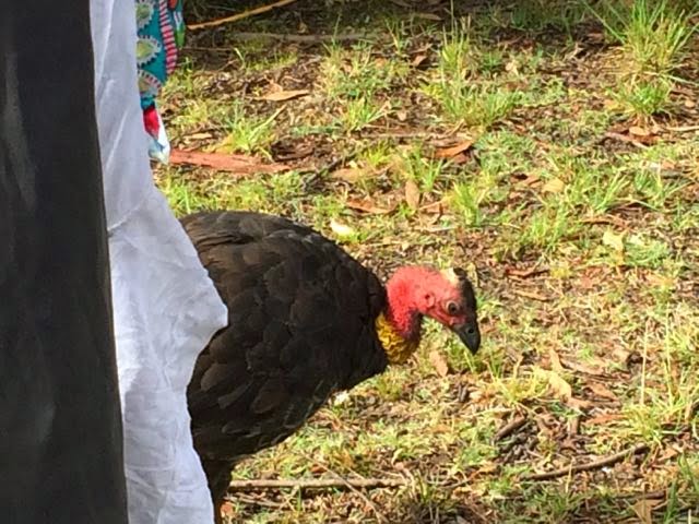
The locals.....don't like one of them....guess which one?

We like the area, all that space and greenery…it is a bit of peace surrounded by the hustle and bustle of the metropolis that is Sydney.
You can just see the skyline of the suburb of Chatswood through the trees.  
Electricity from the Sun...10KWh in size, it produces enough power to energise 2-5 average homes and save approximately 15 tonnes of carbon emission from the atmosphere each year.  


Until next time Sydney.....