Friday, 30 January 2015

Bye Bye Brisbane....hello Pottsville (27 January 2015)

I am not going to write much about Brisbane, because to me, Australian major cities are pretty much the same ....  lots of people and traffic, lots of time spent waiting at traffic lights and if shopping is your thing, then the shops are all the same too.  Of course, cities do have icons that distinguish them from each other,  lovely restaurants and often surrounding by scenic spots and Brisbane is no different.  There is the Brisbane River, South Bank, the Glass House Mountains and the pretty townships of Eumundi, Maleny and Montville.  These places are well worth a visit and we   have done so on a number of occasions because we have been to Brisbane many times.

This time, we stopped at Lawnton (Brisbane) over the Australia Day Long Weekend to visit two friends and to pick from things from Kedron for our van.  We needed to replace the internal water filter which should be done every year but there was an issue with the water when we were Atherton and we ended up with mud in the external filter which meant that the internal one would be compromised as well.  The internal filters we use are hard to get so we bought a spare as well as a couple of sacrificial anodes for the Electric/Gas water heater which are also difficult to source. You learn in Australia to be prepared...if you want one, buy two.

We had lunch with friends at a Turkish restaurant in Bulimba, a suburb located 4 kms north east of the Brisbane CBD on the southern bank of the Brisbane River. We didn't see them but the area has a number of historic buildings and is also home  to several Army Cadet Units at the Bulimba Barracks.  Anyway, it was a very hot day, but we enjoyed the company ...it was a timely visit as one of our friends was celebrating his  birthday. Food was pretty good too.

Then, the next day, we whiled away a couple of hours having lunch with another friend on Australia Day at a near by Tavern.  I had  been very hot and the aircon was not up to scratch but the meal and company was great.

Had a look and found another van park close by.  Tom (our GPS) took us to this park via a number of narrow back streets.  When we got there we found out they have no sites as it is a permanent park and not only that, they were closed for lunch.

So, we drove to where the TV people were, double parked the rig and Nick went in to get the remote, leaving me there in case we had to move.  Got the remote and decided to get out of Brisbane and make our way down the coast.

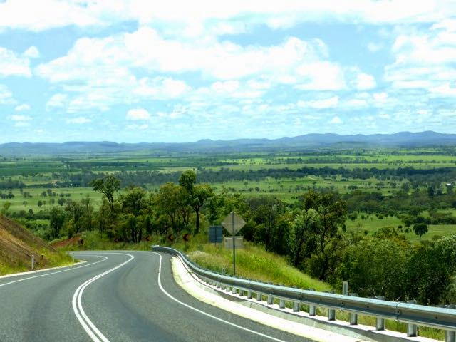
We stopped at Pottsville, a quaint little holiday village on the Tweed Coast where we stayed overnight.

Not my photos ....but a pretty ones of Pottsville
Bill Potts owned the first house in Pottsville around 1930 and the location was initially named Potts Point. Soon though, the town was renamed Pottsville to alleviate any confusion with the place of the same name in Sydney.  Next day..... Corindi Beach - a favourite little spot of ours.

Monday, 26 January 2015

Clermont to Brisbane (22 & 23 January 2015)

Established in 1864, Clermont is a small agricultural town as well as a hub for large coal mines in the area and is located some 945 km north of Brisbane in Queensland. The 2011 census recorded a population of 2177.

Clermont is named after Clermont-Ferrand in France; Clermont-Ferrand was the ancestral home of Oscar de Satge, one of the first European graziers who owned the Wolfang Downs pastoral run.

Originally. Clermont was built on low lying ground next to a billabong (lagoon), and it turned out that flooding was a major problem.  There were four substantial floods between 1864 and 1896 with the biggest flood being in 1916.  A total of 65 people died and with the population at the time being only 1,500, that was quite considerable. It was a great loss and I would imagine it was a big impact on the community.

The 1916 flood remains one of Australia's worst natural disasters in terms of life lost. Following the flood, many of the wooden buildings of the town were moved to higher ground using steam traction engines.  A local amateur photographer, George Pullar took numerous photographs of the moving buildings, published in the 1980s as "A Shifting Town".

Leo Hotel being moved along Lime Street after the flood
Gold was discovered in 1861 which lead to the town being established.  The goldfield was proclaimed in 1862 and copper was discovered soon after.

In the 1880s up to 4000 Chinese people were resident in Clermont, mining for gold and copper. This led to racial riots and the Chinese were removed from the region in 1888.

Coal was discovered in 1864, 20 kms north west of Clermont but was only first mined in 1890.  This mine, Blair Athol, supplied customers in Asia and Europe with up to 12 million tonnes of thermal coal per annum before closed 122 years later in November 2012 when the coal ran out.

Located 12 kms north west of the township, the Clermont Mine began operations in April 2010. When the mine reaches full capacity it will produce up to 12.2 million tonnes of thermal coal for international markets.  In October 2013, RIO Tinto sold its 50.1 per cent stake in mine to fellow mining giant Glencore-Xstrata and Sumitomo for just over $US1.05 billion.

The railway was extended north from Emerald to Clermont in February 1884. We saw about 5 or 6 very long coal trains with up to 5 engines either coming or going, so the line is very busy these days.  However, no passenger trains are available to or from Clermont.

Murals at Clermont

Well, we stayed overnight at Clermont, had a walk around the town in the morning and then headed off to Dululu with me driving.  I have not towed the van before, but Nick is a good teacher and he said I did very well.  You have to drive in "sports mode" which is using the gears rather than automatic to get good fuel economy and also to look after the engine, especially so that it doesn't overhead going up the hills, of which there where quite a few.

The beauty of our new lifestyle is that every thing is subject to change, and when we drove into Dululu just around 2pm, we decided to continue on a further 72 kms to Biloela.

We stayed at the Discovery Caravan Park there which turned out to be a dump....not recommended at all  (note to self....put comment on Trip Advisor).  The good thing was that there was another Kedron parked next to us,  owned by Ralph.  Unfortunately, Ralph's wife had taken ill and was in hospital so Nick did the decent thing and spent a couple of hours with Ralph, sitting outside talking about this and that, as you do, with a number of glasses of wine of course.

We decided to go straight through to Brisbane the following day.  There have been some significant rains in the ares and it is lovely a green.  Below are photos taken on the road near Cania Gorge National Park.


Next Stop.....Brisbane or as it is quaintly known, BrisVegas.

Thursday, 22 January 2015

On the move again

Atherton is a picturesque rural community about 92 kms from Cairns by road.   Predominately  a farming area with all the usual suspects for a tropical climate.....bananas, sugar cane, potatoes, peanuts, maize, avocados, coffee, tea, pineapples and other tropical fruits such as mangos, papaya, limes, dragon fruit and lychees.  Of course there are a number of farms gates with fresh vegies as well.   There is a buffalo farm that produces buffalo milk and cheese, plus goats and cows for milk products and artisan cheeses, hand made chocolates, fruit wines and liquors, beautiful waterfalls,  B & B's, a number of dams for water sports and fishing, camping....tell me again why I am leaving......

Atherton as seen from Bones Knob, Tolga
Some locals....Curlews, noisy little things at night
Look carefully, Nick is there ;)
View from Hallorans Hill
Now these are horns!!!
The truth is we will most probably come back here to live when we have finished our travels, but that is well into the future. 

Our first stop.......Charters Towers, a heritage city, which is 483 kms south west of Atherton, where we have spent two days touring.

The World Theatre
Inside the Stock Exchange Arcade.  A National Trust building, the Stock Exchange Exchange was built in  1887-88
City Hall - built in 1891, it was originally the Queensland National Bank
Post Office, built in 1892, the clock tower was added in 1989
Charters Towers sense of humour
The approaching Storm
Gold was discovered here in 1871 by Hugh Mosman, George Clarke, John Fraser and the party's horse boy, a young Aboriginal, Jupiter, who is credited with finding the nugget of alluvial gold which started the rush.  The goldfield was proclaimed in 1892 which turned Charters Towers (or just Charters to the locals) into a bustling metropolis, which in its heyday boasted as being the second largest city in Queensland. 

The Royal Private Hotel, built in 1988.....a bygone era restored. 
Between 1872 and 1924, approximately 30 vertical underlying shafts and tunnels were dug by the large number of miners who worked their claims in the hope of fining the reefs below Towers Hill.  Many of these are still visible. At the height of the gold rush there where 29 crushing mills, 95 hotels and one of the very first regional Stock Exchanges in Australia.  
The buildings are beautiful and although it was 39c in the shade, we still walked around the town, following a trail what is known as the "one square mile". We visited the Stock Exchange which is now an arcade, the Assay Mining Museum, the World Theatre which is a beautiful building.  There are so many lovely buildings in Charters, including the Visitors Centre which is housed in what was once the Union Bank, built in 1880.  

We drove out to the Macrossan Bridge Flood Marker to see the heights that the Burdekin River has reached over the years....it is hard to imagine the river being that high when you are standing next to it. 
Macrossan Bridge Flood Marker - the second from the top was the flood level in 2009.
We also drove up Towers Hill, saw some mine shafts and some of the 30 bunkers which were used to store bombs, detonators and ammunition for use by the Townsville based RAAF which is 92 kms away.  The camouflaged bunkers had ramparts of rock rubble placed near the entrances to slow down and deflect the force of any explosion inside and none of the bunkers face each other to ensure that an explosion in one did not set off explosions in others.  

A Seismograph Station was installed in 1958, the International Geophysical Year.   Since 1962, the Towers Hill Station has been part of the United States of America Iris world wide network of 120 seismic stations.  Recordings are digitised and sent to the University of Queensland in Brisbane and then on to the USA.  

Some facts about Charters Towers supplied by the Lions Club include:


  • Charters is 1100 feet or 335.2 m above sea level
  • The annual average rainfall is 644 mm
  • The first gold escort took 29 000 oz out of Charters Towers, and the second 31 000 oz
  • In 1887, gold was $4.40 an oz.
  • In 1887 a miner eared $6.00 per week.
  • A tradesman earned 80 cents per day
  • A bottle of 3 star Brandy cost 80 cents.  
  • In 1875, rump steak was 10 cents a kilo.
  • The population was once 30,000.
  • The deepest shaft on the field was the Brilliant Extended.....3040 feet or 926.6 m.
  • The largest nugget was the Prince  of Wales, weighing in at 143 oz 12 dwts, found by Tom Hoy. The charters Towers fire Fire Brigade purchased its first motorised vehicle in 1916. 
  • The Charters Towers Region which includes Pentland, Greenvale, Homestead, Ravenswood, Mingela and Balfes Creek is larger that the State of Tasmania. 
  • During WWII, 15,000 US personnel were stationed in Charters Towers.

It is the wrong time of year to be touring around here.  It you like heritage architecture, gold mining and anything to do with WWII, then this is where you should come but do so in the dry season.  Maybe we will return one day to spend more time here.  

We packed up this morning in the rain, and headed off to Clermont on our way to Brisbane.  The rain seems to have abated for now, but it looks like there is more on the way.  Tomorrow we are off to Dululu. 

Wednesday, 21 January 2015

I am owning up

I am owning up…..my blog is not up to date !!!!  Apart from my post about parting company with John and Deb, the last post was at  Wave Rock in Western Australia.  Since then we have been through South Australia, Victoria, New South Wales and Queensland, so I have quite a bit of catching up to do, which I intend to do over time. 

Also, the dates a post was done is not necessarily the date we where at the place I wrote about.  Here is where we have been, starting on day 1 when be left Atherton, Far North Queensland for Mt Surprise on 26 April 2014 up to and including 11 November 2014 when we arrived back in Atherton, Far North Queensland where the journey began.  

Day Place / State or Territory

1 & 2       Mt Surprise, Queensland

3               Normanton, Queensland

4 - 7          Mt Isa, Queensland

8 - 10       Camooweal - Billabong on Georgina River, Queensland

11            Attack Creek, Northern Territory

12            Daly Waters Pub, Northern Territory

13            Adelaide River, Northern Territory

14 - 23     Darwin, Northern Territory

24            Bridge Creek, Northern Territory

25            Gregory, Northern Territory

26            East Raine River, Northern Territory

27 - 29     Wyndham, Western Australia

30            Mary Pool camp area, Western Australia

31            Nillibubbica Rest area, Western Australia

32            Sandfire Roadhouse, Western Australia

33            Port Headland, Western Australia

34 - 36     Dampier, Western Australia

37 - 38     Robe River Bush Camp, Western Australia

39            Nanutarra, Western Australia

40 - 41     Barradale Bush Camp, Western Australia

42 - 45     Carnarvon, Western Australia

61 - 62     Geraldton, Western Australia

63             Cervantes / Pinnacles Desert - Western Australia

64 - 87      Perth, Western Australia

88              New Norcia, Western Australia

89              York, Western Australia

90               Kwolyin bush camp, Western Australia

91 - 93       Tressie's Museum and Caravan Park, Western Australia

94               Burracoppin Free Camp, Western Australia

95 - 98        Kalgoorlie - Boulder, Western Australia

99               Bromus Dam bush camp, Western Australia

100 - 103    Esperance, Western Australia

103 - 104    Fraser Ranger Station, Western Australia

105             Madura Pass Lookout

106             164 peg bush camp on the Nullarbor, South Australia

107 - 108    Smoky Bay, South Australia

109 - 113    Streaky Bay, South Australia

114 - 115    Pildappa Rock Bush Camp, South Australia

116 - 119    Port Lincoln, South Australia

120 - 123   Whyalla, South Australia

124 - 126   Nurioopta, Barossa Valley, South Australia

127 - 133   Mount Barker, Adelaide Hills, South Australia

134            Cameron's Reserve Bush Camp, Nhill, Victoria

135            Marong, Victoria

136 - 145   Dingley Village, Melbourne, Victoria

146             Rosedale Bush Camp, Victoria

147 - 150    Lakes Entrance, Victoria

151 - 152    Genoa rest area Bush Camp, Victoria

153 - 157    Merimbula, New South Wales

158 - 165    Burril Lake, New South Wales


166 - 179  Lane Cove National Park, Sydney, New South Wales

180           Lithgow, New South Wales

181           Dubbo, New South Wales

182           Narrabri, New South Wales

183 - 184 Toowoomba, Queensland

185 - 197 Lawnton, Brisbane, Queensland

198          Gin Gin, Queensland

199          Clairview, Queensland

200          Deeragun, Townsville, Queensland

201         Atherton, Far North Queensland         

We were on the road for 200 days,  165 of those days we travelled with our good friends John and Deb.  We have had an awesome time together, seeing what there is to see and making good memories.  You can see that we have moved pretty quickly in some places but Australia is a big country so sometimes there are huge distances to travel to get from one place to another.  The distances and the changes it brings is part of the enjoyment of travelling in Australia.  Some are daunted by the distances but if you look you will see changes everywhere although some are very subtle.  

Monday, 6 October 2014

Australia - its bloody big mate!!

No disrespect to people living in Europe and the UK but this map that I found in a tour book gives some perspective on how big Australia actually is, even though this map is in reference to Western Australia.


Nick and I, along with our good friends John and Deb has travelled together for 165 days.  We part company tomorrow which is sad but we have had a good trip together and have great memories of the places we have been to.

Farewell BBQ complete with Trilogy Pink Champagne and Margaret River Three Bears Semillon Sav Blanc

We departed from Atherton in the State of Queensland on the 26 April 2014,  travelled through to the Northern Territory, then through the States of Western Australia, South Australia, Victoria and now we are in New South Wales.  (yes, I know my travel blog is not up to date, but being retired and travelling is “busy work" ).

Some facts and figures:-


  • We have travelling some 17,500 kms
  • We have spent Aus $5600 on diesel fuel
  • We have stayed in 51 locations
  • Of those 51 places, 15 of them have been bush camps (note to self…more bush camping required)
  • We have had 15 fabulous fires (thanks to John’s battery operated chain saw and both Nick and John’s pyrotechnic tendencies)
  • We have experienced weather from 40c to 2c celsius (yay for thermals)
  • We have endured umpteen flies and red dirt in the Northern Territory and the top part of Western Australia, a two day plaque of bush bees in Whyalla (South Australia) and a one day plague of flying ants in Merimbula  (NSW)
  • We have endured cold fronts in Western Australia which in North Queensland, would be called cat 1 or 2 Cyclones
  • We have met and shared experiences with many fabulous people
  • Seen many places that we would like to return to one day and many more that we missed this time round that are earmarked for the future
  • We have enjoyed many a meal cooked cooked by either Deb or Gail with ample aid from John and Nick
  • We have enjoyed many a glass of wine
  • We have enjoyed visits to many wineries, cheese places and chocolate places
  • We have seen fantastic sunsets and sunrises
  • We have seen and experienced many places of great beauty and history 

Mainly, Nick and I know that we love this great big country of ours and look forward to many more years “living on the road” in Australia.

Tuesday, 16 September 2014

Surfing Wave Rock


From Kowlyin we headed for Karlgarin to use it as a base to explore the area.  We stayed at a fantastic Caravan Park called Tressie’s for three nights.   It is on part of a large family farming enterprise and is managed  by Laurel and Merv.    Merv was no longer able to do many things on the farm so he wanted to start up a caravan park to keep himself busy.  It took some three years for the plans to be passed through council  (seems councils are the same everywhere...incredibly slow).   Merv put a lot of thought into the design of the park and although it is some eight years old, you wouldn't know it.  It is spotlessly clean and Merv and Laurel are very friendly and helpful.  Merv also has a museum and for $3 you have a look back in time on a museum tour which he runs twice a day.

I’ve got to tell you, the $3 is well worth it.  His private collection has been a labour of love and when he starts the tour, he switches on special lighting and old fashioned music.  He has to refer to his hand written notes, but he did an excellent job.  The show cabinets themselves are a work of art…made right on the farm but he was only the helper he told us, they were actually designed by someone else, I forget who.

Everything is beautifully presented and he has everything in there that you have ever seen (except for one item…more later)  and there were much of “I had one of those”….or “remember them”. Part of it is his very large collection of gramophones and 5000 records.  There are seats so you can sit a listen to the vinyls (LP, 33 or 33 1/3 rpm) or records (78 rpm) he plays or any of your favourite tunes from his catalogue.

The one thing he has in his collection that is unknown is a metal item marked with the words “the third hand”.  The family has done much research and can't find out anything about it.  Merv asks each visitor doing the tour if they can identify it for him….it is still unknown as to what it is used for.

The weather turned nasty as another cold front was coming through (who would have thought !!) but we were still able to have a fire due to the relocatable metal fire places that Merv designed and the kindling and firewood he had available.  Nobly Mallee tree roots make the best fire wood, they burn hot and long, so we discovered.

Keeping warm at Tressies
We used Karlgarin as a base to visit Wave Rock at Hyden and also to drive along the Tin Horse Highway to Kulin.

Wave Rock is an amazing natural attraction in a reserve 4 klm east of Hyden.  The spectacular granite formation reaching over 15m high and the “wave” is approximately 110m long.   We also visited two other rock formations - Hippo’s Yawn and Mulka’s Cave.
Nick and John Surfing
The other side of the Wave
Nick and Gail at Hippo's Yawn
The town of Hyden was interesting. They play music continuously from the amphitheatre in the centre of the main street…..I mean, it is loud and never stops...during the day that is.  Friendly people though…a lady just stopped us in the street and wanted to know where we were from etc and the people in the coffee shop were lovely too.  The information centre at Wave Rock had a great collection of stuff including stuffed birds and a dried flower arrangement on the ceiling that was spectacular.   We had coffee there and John and Deb had sausage rolls.  A guy from the next table asked John how he like it...it turned out that he bakes them.  He is a motor mechanic by trade but just decided that he would take up baking for a change.  John is a connoisseur of sausage rolls and was happy to oblige with his opinion...."tasty but the sausage meat was a bit soft" -  John prefers it firmer.

Part of the Butterfly flower arrangement on the ceiling.
Nick and his birds.
We had dinner in the Karlgarin local Country Club one night ……sat right in front of the lovely fireplace, good food, a New Zealand Chef with a wicked sense of humour.... good night was had by all.

The following day we laughed our way down the 15 Km Tin Horse Highway to Kulin stopping to take photos of the “community art” along the way.   I have twenty three photos of different and quirky creations.  Unfortunately, can't put them all here.


Since 1995, Tin Horses have been popping up along the highway as farmers try to outdo each other.  They even have an annual competition where you can go in the running to win a share of generous prize money for the best “Tin Horse”.... and there are some very specific guidelines.  The judging takes place  by public vote and the winner is announced at annual Kulin Bush Races.   We had lunch at the Kulin hotel… had the best, juiciest, succulent Chicken Parma ever.   They were holding a darts competition at the time….serious stuff by all accounts.

PS...Leave a comment to let me know how the photo's are...most of them that I have posted here are at a lower resolution so that I can put more on.

Monday, 15 September 2014

Kwolyin Bush Camp

Well, we were heading east from York, the plan being to visit Kokerbin Hill (Australia's 3rd largest monolith) and we would have driven right past it if it wasn't for Trevor.

Watch out..... its going to fall on your head.
As we were travelling along Quairading Road, somewhere close to the township of Yoting, a guy in his vehicle on a private road was waiting to turn onto the main highway as we passed him. John dropped back to channel 40 on the UHF just in case the guy wanted to speak to us……that was Trevor.   Well, Trevor did speak to us and we found out from him that we were not far from Kokerbin Rock and that there was a fantastic bush camp at Kwolyin. So, that is why, if not for Trevor, not only would we have driven right past Kokerbin, we would also not have known about Koberbin Bush Camp.

In 2008 the Western Australian Government instigated a program called the "Royalties for Regions" where they have focused on development that is supported with the reinvestment of mining and onshore petroleum royalties on regional projects.  Kwolyin was one of those areas that benefited. 

Under the Royalties for Regions program, the Bruce Rock Shire opened an excellent new bush campground at Kwolyin which has flush toilets, hand basins, camp kitchen with a gas hob, covered and uncovered picnic tables, gas BBQ’s and good water supply with plenty of water pressure.   It has been designed with individual caravan sites as well as group camping/tent sites.  

Kowlyin used to be a small town in the Wheatbelt region of WA which was settled in 1908. The townsite was selected in 1912 due to its position near a spring and the townsite was gazetted in 1913, the same year that the railway opened between Quairading and Bruce Rock.  

There seemed to be some rivalry between the next town, Shackleton… after all, Kowlyin had a pub  (hotel) and Shackleton didn’t.  The Kowlyin pub was a two story building of brick construction located on 1/2 acre of land opposite the Kwolyin Railway Station.  The closest other pub was Bruce Rock, so you can see why it was popular and a social hub.   The Pub opened in 1914 and was demolished after it was burned down in 1992. There was speculation that the owner was responsible but it could not be ruled out that some one else, perhaps from Shackleton was the culprit.  However, in January 2012, a cold case investigation saw a Port Kennedy man and women charged over the devastating fire.

Kowlyin Pub after the fire (file photo from the internet).  There is nothing there now. 

Kowlyin is now a ghost town….the only sign that it was once a thriving little town is the cricket pitch and the Church.  
Cricket Pitch


Shackleton, only seven kilometres up the road has survived well and is home to a number of people including artist Steve and his wife Christina.  Steve uses chicken wire fencing and discarded metal bits and pieces to design very interesting sculptures. 

When we called to say “g’day” to Steve at his Art Studio, he was working on his cafe called “Floe’s Place” which he hopes will entice more people to stop in the town.  Although we didn't go into the Art Studio, the garden is an artwork itself, full of interesting sculptures.  


Bank in Shackleton
Shackleton, was also home to the smallest bank in Western Australia.  Originally, the 3 x 4 meter building was the Bank of New South Wales before it became Bankwest.  It was also used as an aircraft observation centre in WWII and at one time was a child health centre. 

It was windy and cold along with a sprinkle of rain at the Kowlyin bush camp.  Nick and John set up a tarp as a wind break and collected firewood with the aid of John’s battery operated rechargeable chain saw.  I went looking for something that could be used as a wind break and came across some small sheets of corrugated iron.  I got Nick to come and get it.  He picked up one sheet and we both got a fright as the blue tongue lizard that was living under it demonstrated quite clearly that he was not happy about being disturbed.   Nick said it was a rather silly thing to do, picking it up with his hands as it could have been a snake.  He put the sheet of iron back as it was the lizards home and with a stick, looked under two other small sheets before picking them up and taking them back to the fire. 

 
Deb sheltering against the tarp keeping out of the wind and rain
Nick and John cutting up firewood
Nick tending the fire (note the small corrugated iron sheets)
We thoroughly enjoyed our bush camp there but pressed on the following day to Karlgarin.